
Rikcha:LocationIndia.png

Kay ñawpaq qhawariypa chhikan kaynin: 800 × 370 iñu. Huk huyakukuna: 320 × 148 iñu | 640 × 296 iñu | 1357 × 628 iñu.
Qallariy willañiqi (1357 × 628 iñu; willañiqip chhikan kaynin: 21 kB; MIME laya: image/png)
| Kay willañiqiqa kay uranpi yapa willasqakunapas Wikimedia Commons sutiyuq chawpi midya hallch'amantam ch'aqtasqa. | Commons nisqapi ch'uyanchana p'anqaman |

|
Esta imagen debería volverse a crear como imágenes vectoriales SVG. Esto proporciona muchas ventajas, véase Commons:Media for cleanup (en inglés) para más información. Si ya hay una versión SVG de esta imagen disponible, por favor súbala a Commons. Tras subirla, reemplace esta plantilla con la plantilla
{{vector version available|nuevo nombre de imagen.svg}} en esta imagen. |
Pisichay
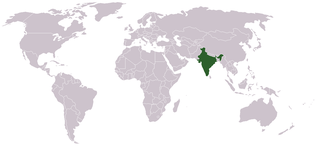
Location map for w:India.
User:dbenbenn modified Image:BlankMap-World.png.
Saqillaspa
| |
Esta imagen ha sido (por este medio) publicada en el dominio público por su autor, Vardion en el proyecto Wikimedia Commons. Esto se aplica mundialmente. En caso de que no sea legalmente posible: |
Willañiqip wiñay kawsaynin
P'unchaw/pacha nisqapi ñit'iy chaypacha willañiqi kachkasqata qhawanaykipaq.
| P'unchaw/Pacha | Uchuylla rikchacha | Chhikanyachikuqkuna | Ruraq | Willapuy | |
|---|---|---|---|---|---|
| kunan | 07:35 11 sit 2021 | | 1357 × 628 (21 kB) | Ytpks896 | Reverted to version as of 22:39, 12 February 2005 (UTC) |
| 13:37 29 hul 2021 |  | 1427 × 628 (103 kB) | Ytpks896 | Reverted to version as of 03:16, 1 May 2008 (UTC) | |
| 00:33 15 phi 2010 |  | 1357 × 628 (24 kB) | King Zebu | Reverted to version as of 09:17, 3 June 2005 Please discuss before making such edits in future. | |
| 03:16 1 may 2008 |  | 1427 × 628 (103 kB) | KAVO | (Changed to colours more noticeable: *Light green - Claimed by India, not administered by India **(Aksai Chin, Azad Kashmir, Northern Areas, Shaksgam Valley) *Deep Green - Disputed with other nations, administered by India **(Arunachal Pradesh, Jammu and | |
| 09:17 3 hun 2005 |  | 1357 × 628 (24 kB) | Nichalp | NPOV map, please discuss any changes with me for NPOV status | |
| 22:39 12 phi 2005 |  | 1357 × 628 (21 kB) | Dbenbenn | higher resolution version, without black border | |
| 20:28 5 dis 2004 |  | 250 × 115 (18 kB) | EugeneZelenko | Location map for India.<br/>Originally created for English Wikipedia by Vardion.<br/>{{GFDL}} |
Maypim willañiqita llamk'achinku
Kay rikchamanqa manam ima p'anqakunachu t'inkimun.
Mayqin wikikunapi willañiqita llamk'achinku
Kay wakin wikikunam willañiqitaqa llamk'achinku:
- ar.wikinews.org-pi kaykunapi llamk'achinku
- ckb.wikipedia.org-pi kaykunapi llamk'achinku
- en.wikipedia.org-pi kaykunapi llamk'achinku
- en.wikinews.org-pi kaykunapi llamk'achinku
- en.wikivoyage.org-pi kaykunapi llamk'achinku
- en.wiktionary.org-pi kaykunapi llamk'achinku
- fr.wikinews.org-pi kaykunapi llamk'achinku
- fur.wikipedia.org-pi kaykunapi llamk'achinku
- he.wikivoyage.org-pi kaykunapi llamk'achinku
- hr.wikipedia.org-pi kaykunapi llamk'achinku
- hr.wikiquote.org-pi kaykunapi llamk'achinku
- incubator.wikimedia.org-pi kaykunapi llamk'achinku
- ko.wikipedia.org-pi kaykunapi llamk'achinku
- li.wikinews.org-pi kaykunapi llamk'achinku
- pam.wikipedia.org-pi kaykunapi llamk'achinku
- pl.wiktionary.org-pi kaykunapi llamk'achinku
- ps.wikivoyage.org-pi kaykunapi llamk'achinku
- pt.wikivoyage.org-pi kaykunapi llamk'achinku
- pt.wiktionary.org-pi kaykunapi llamk'achinku
- sr.wikibooks.org-pi kaykunapi llamk'achinku
- sv.wikinews.org-pi kaykunapi llamk'achinku
Qhaway mayqin wikikunapim willañiqita llamk'achinku.