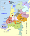
Rikcha:Map provinces Netherlands-de.svg

Contenido de la página no disponible en otros idiomas.
Wikipediamanta

Qallariy willañiqi(SVG willañiqi, rimasqakama 743 × 881 iñuyuq, willañiqip chhikan kaynin: 516 kB)

Kay willañiqiqa kay uranpi yapa willasqakunapas Wikimedia Commons sutiyuq chawpi midya hallch'amantam ch'aqtasqa. Commons nisqapi willañiqi ch'uyanchana p'anqaman riy Commons nisqapi ch'uyanchana p'anqaman
 
Este gráfico vectorial, sin especificar según el W3C, fue creado con Inkscape .
Translate this file This SVG file contains embedded text that can be translated into your language, using any capable SVG editor, text editor or the SVG Translate tool. For more information see: About translating SVG files.

Pisichay

T'iktuna
Deutsch: Karte der Niederlande, mit den Provinzen, den Karibischen Niederlanden, den Großstädten, den Flüssen und den Seen. Die deutsche Version.
English: Map of the Netherlands (including the special municipalities of Saba, Saint Eustatius and Bonaire; the Caribbean Netherlands), showing provinces, large cities, rivers and lakes. German Version.
Pukyu Kikinpa rurasqan
Ruraq Alphathon
Huk musuqchasqakuna

[qillqay]

Saqillaspa

Ñuqaqa, kay rurasqaypa iskaychay hayñiyuq kaqnin, kaywan rurasqayta uyaychachkanim kay qatiq saqillaykunawan:
w:es:Creative Commons
Ruraqpa sutinta willay Kay hinallataq rakinakuy
Qispilla rurarillay:
  • rakinakuy – iskaychay, mast'ariy, maymanpas kachay kay rurasqata
  • musuqmanta chaqruy – rurasqata tupayay
Kay phatakuna tukuptinqa:
  • Ruraqpa sutinta willay – Kay rurasqataqa ruraqninpa icha saqillaqninpa sut'ichasqan hina unanchanaykim (ichataq amapuni kay hinachu, pay q'imisunkiman icha rurayniykita q'iminman rikch'akunman).
  • Kay hinallataq rakinakuy – Kay rurasqata hukchaspayki wakinchaspayki icha paymanta musuqta ruraspaykiqa, musuq rurasqaykita kikillan icha payman kaqlla saqillayllawanmi mast'arinkiman.
GNU head Saqillayqa huñikusqam kay atiqllata iskaychaypaq, mast'ariypaq icha wakinchaypaq kay saqillaypa phatankunakama: GNU Free Documentation License, musuqchasqa 1.2 icha ima qhipaqnin kaq musuqchasqapas Free Software Foundation nisqap uyaychasqan; mana "mana wakinchana rakinakuna", "ñawpaq qata p'anqa" icha "qhipaq qata p'anqa" nisqa qillqayuq. Saqillaypa iskaychasqanqa GNU Free Documentation License nisqa rakipi ch'aqtasqam.
Munasqayki saqillayta akllariy.

Leyendas

Añade una explicación corta acerca de lo que representa este archivo

Elementos representados en este archivo

representa a Español Simi

creador Español Simi

Algún valor sin elemento de Wikidata

Willañiqip wiñay kawsaynin

P'unchaw/pacha nisqapi ñit'iy chaypacha willañiqi kachkasqata qhawanaykipaq.

(Qhipaqkuna | Ñawpaqkuna) Qhaway (aswan musuq 10) () (10 | 20 | 50 | 100 | 250 | 500).
P'unchaw/PachaUchuylla rikchachaChhikanyachikuqkunaRuraqWillapuy
kunan21:03 24 mar 201621:03 24 mar 2016-pa musuqchasqanmanta uchuylla rikchacha743 × 881 (516 kB)FurfurScheldt -> Schelde, Nether Rhein -> Niederrhein, Antwerp -> Antwerpen
14:42 14 nuw 201514:42 14 nuw 2015-pa musuqchasqanmanta uchuylla rikchacha743 × 881 (888 kB)TimmaexxRhine -> Rhein
08:40 15 ukt 201408:40 15 ukt 2014-pa musuqchasqanmanta uchuylla rikchacha743 × 881 (888 kB)Bibi Saint-Pols/GroßStadt/Großstadt/
16:54 14 ukt 201416:54 14 ukt 2014-pa musuqchasqanmanta uchuylla rikchacha743 × 881 (888 kB)Bibi Saint-PolImprove map with conventional colors and markers, using Liberation fonts for optimal Mediawiki rendering
21:22 25 hul 201221:22 25 hul 2012-pa musuqchasqanmanta uchuylla rikchacha743 × 881 (1,34 MB)Thomas5388Meuse -> Maas
23:15 10 phi 201123:15 10 phi 2011-pa musuqchasqanmanta uchuylla rikchacha743 × 881 (1,34 MB)AlphathonNew version with fixed borders and special municipalities
11:53 30 awu 201011:53 30 awu 2010-pa musuqchasqanmanta uchuylla rikchacha743 × 881 (698 kB)AlphathonFixed error and "Vlissingen" label
11:48 30 awu 201011:48 30 awu 2010-pa musuqchasqanmanta uchuylla rikchacha743 × 881 (697 kB)AlphathonFixed "Schelde" labels
11:38 30 awu 201011:38 30 awu 2010-pa musuqchasqanmanta uchuylla rikchacha743 × 881 (698 kB)AlphathonAccidental removal of objects
11:36 30 awu 201011:36 30 awu 2010-pa musuqchasqanmanta uchuylla rikchacha743 × 881 (698 kB)AlphathonEN: Made all province shapes representative of actual shape; previously there were hidden sections underneath other provinces
(Qhipaqkuna | Ñawpaqkuna) Qhaway (aswan musuq 10) () (10 | 20 | 50 | 100 | 250 | 500).

Kay rikchamanqa manam ima p'anqakunachu t'inkimun.

Mayqin wikikunapi willañiqita llamk'achinku

Kay wakin wikikunam willañiqitaqa llamk'achinku:

Metadata

"https://qu.wikipedia.org/wiki/Rikcha:Map_provinces_Netherlands-de.svg" p'anqamanta chaskisqa (Wikipedia, Qhichwa / Quechua)