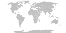
Rikcha:BlankMap-World-Compact.svg

Contenido de la página no disponible en otros idiomas.
Wikipediamanta

Qallariy willañiqi(SVG willañiqi, rimasqakama 2560 × 1134 iñuyuq, willañiqip chhikan kaynin: 1,01 MB)

Kay willañiqiqa kay uranpi yapa willasqakunapas Wikimedia Commons sutiyuq chawpi midya hallch'amantam ch'aqtasqa. Commons nisqapi willañiqi ch'uyanchana p'anqaman riy Commons nisqapi ch'uyanchana p'anqaman
Este mapa is saved in human-editable plain text format. Any editing of the image or creation of any derivative work should be performed using a text editor. Please do not upload edits saved or exported with Inkscape or similar vector graphics editors, as well as with automated tools such as SVG Translate.
Warning This Robinson projection map without the earth's elliptical outline is professionally not recommended to be used. See here.
T'iktuna

Detailed SVG map with grouping enabled to connect all non-contiguous parts of a country's territory for easy colouring. Smaller countries can also be represented by larger circles to show their data easier. A thorough description of use and other instructions can be found on the instruction page for the non-compact map.

This is a more compact version of BlankMap-World.svg where Antarctica has been removed. Please make any updates primarily to the other map since this one should be kept as identical to the original as possible.
P'unchaw
Pukyu Based on BlankMap-World.svg
Ruraq Canuckguy et al.
Saqillay
(Kay willañiqita musuqmanta llamk'achiy)
Public domain Ñuqaqa, kay rurasqaypa iskaychay hayñiyuq kaqnin, rurasqayta Sapsi Chaskinancha nisqamanmi kacharichkani. Kayqa tukuy Tiksimuyuntinpim chanin.
Huk mama llaqtakunap kamachiyninkunaqa manachá saqillankuchu; hinaptinqa:
Ñuqaqa pitapas saqillani kay rurasqayta llamk'achiyta imapaqpas, mana phatawanchu, chay hina phatakuna mana kamachiypa kamachiptinkama.
Huk musuqchasqakuna
Original version including Antarctica and elliptic outline of the ocean
Derivative works of this file:
SVG desarrollo
InfoField
 
El código fuente de esta imagen SVG es válido.
 
Esta imagen vectorial fue creada con Inkscape, y luego editada manualmente
.
Annotations
InfoField
This image is annotated: View the annotations at Commons

Leyendas

Añade una explicación corta acerca de lo que representa este archivo

Elementos representados en este archivo

representa a Español Simi

14 dis 2007

tipo de archivo Español Simi

image/svg+xml

suma de verificación Español Simi

632e9b62855a9ab28da328c9ab96213b5862d936

método de determinación Español Simi: SHA-1 Español Simi

tamaño de los datos Español Simi

1 055 892 byte

altura Español Simi

1134 píxel

ancho Español Simi

2560 píxel

Willañiqip wiñay kawsaynin

P'unchaw/pacha nisqapi ñit'iy chaypacha willañiqi kachkasqata qhawanaykipaq.

(Qhipaqkuna | Ñawpaqkuna) Qhaway (aswan musuq 10) () (10 | 20 | 50 | 100 | 250 | 500).
P'unchaw/PachaUchuylla rikchachaChhikanyachikuqkunaRuraqWillapuy
kunan12:56 11 ukt 202312:56 11 ukt 2023-pa musuqchasqanmanta uchuylla rikchacha2560 × 1134 (1,01 MB)YodinLatest version is minified, and no longer easily text-editable; Reverted to version as of 14:50, 16 March 2019 (UTC)
17:07 10 ukt 202317:07 10 ukt 2023-pa musuqchasqanmanta uchuylla rikchacha512 × 227 (754 kB)Ahmed0arafatfix african countries count to 54
14:50 16 mar 201914:50 16 mar 2019-pa musuqchasqanmanta uchuylla rikchacha2560 × 1134 (1,01 MB)GomolokoI corrected Transnistria tag showing in a larger area than it should, instead of Moldova
07:09 11 mar 201907:09 11 mar 2019-pa musuqchasqanmanta uchuylla rikchacha2560 × 1134 (1,01 MB)GomolokoI corrected West Bank (State of Palestine) name not showing when the mouse was over the area
00:51 11 mar 201900:51 11 mar 2019-pa musuqchasqanmanta uchuylla rikchacha2560 × 1134 (1,01 MB)Gomolokolast change :) Gambia, Republic of The
00:25 11 mar 201900:25 11 mar 2019-pa musuqchasqanmanta uchuylla rikchacha2560 × 1134 (1,01 MB)GomolokoI reverted all changes and made only the following according to www.un.org : North Macedonia, United States of America, Eswatini, United Kingdom of Great Britain and Northern Ireland, Cabo Verde
21:02 10 mar 201921:02 10 mar 2019-pa musuqchasqanmanta uchuylla rikchacha2560 × 1134 (1,01 MB)GomolokoNorth Macedonia, Republic of _ Congo, Democratic Republic of the _ Kyrgyz Republic _ Vietnam, Socialist Republic of _ China, People's Republic of _ United States of America _ Eswatini, Kingdom of _ Cabo Verde, Republic of
21:55 10 phi 201821:55 10 phi 2018-pa musuqchasqanmanta uchuylla rikchacha2560 × 1134 (1,01 MB)FibonacciUpdated the map with land and water outlines from the original.
19:32 25 awu 201219:32 25 awu 2012-pa musuqchasqanmanta uchuylla rikchacha940 × 415 (1,45 MB)KpengboyReverted to version as of 16:35, 13 February 2012 (there's a reason the code wasn't "optimised". re-add transparency if you think it's better)
20:57 17 awr 201220:57 17 awr 2012-pa musuqchasqanmanta uchuylla rikchacha940 × 415 (818 kB)Fred the OysterCorrected my faux pas with the upper and lower margins
(Qhipaqkuna | Ñawpaqkuna) Qhaway (aswan musuq 10) () (10 | 20 | 50 | 100 | 250 | 500).

Kay rikchamanqa manam ima p'anqakunachu t'inkimun.

Mayqin wikikunapi willañiqita llamk'achinku

Metadata

"https://qu.wikipedia.org/wiki/Rikcha:BlankMap-World-Compact.svg" p'anqamanta chaskisqa (Wikipedia, Qhichwa / Quechua)